
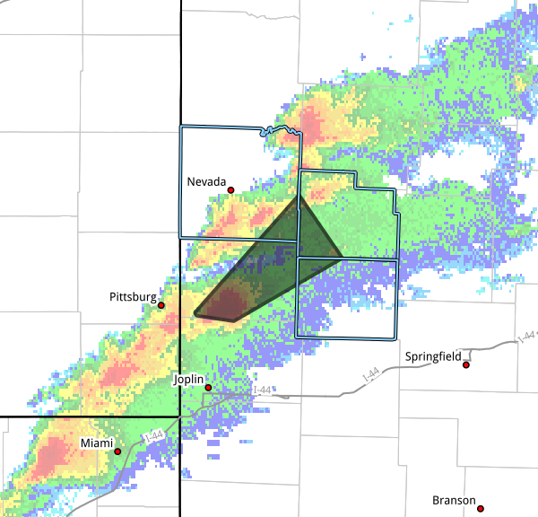
The National Weather Service in Springfield has issued a Severe Thunderstorm Warning for Central Barton County, Southwestern Cedar County, Southeastern Vernon County and Northwestern Dade County until 230 PM CDT.
* At 138 PM CDT, a severe thunderstorm was located 8 miles northwest of Jasper, or 9 miles southwest of Lamar, moving northeast at 40 mph.
HAZARD…60 mph wind gusts and half dollar size hail.
SOURCE…Radar indicated.
IMPACT…Hail damage to vehicles is expected. Expect wind damage to roofs, siding, and trees.
* Locations impacted include…Lamar, Nashville, Montevallo, Jerico Springs, Lamar Heights, Irwin, Milford, Oakton, Olympia, Iantha, Kenoma, Cedarville, and Boston.
This includes Interstate 49 between mile markers 59 and 74.
PRECAUTIONARY/PREPAREDNESS ACTIONS…
For your protection move to an interior room on the lowest floor of a building.
A Tornado Watch remains in effect until 700 PM CDT for southwestern and west central Missouri.


