
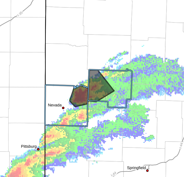
The National Weather Service in Springfield has issued a Severe Thunderstorm Warning for Western St. Clair County and Northeastern Vernon County until 200 PM CDT.
* At 117 PM CDT, a severe thunderstorm was located over Walker, or 10 miles northeast of Nevada, moving northeast at 30 mph.
HAZARD…60 mph wind gusts and quarter size hail.
SOURCE…Radar indicated.
IMPACT…Hail damage to vehicles is expected. Expect wind damage to roofs, siding, and trees.
* Locations impacted include…Appleton City, Walker, Schell City, Roscoe, Harwood, Tiffin, Johnson City, Taberville, and Monegaw Springs.
PRECAUTIONARY/PREPAREDNESS ACTIONS…
For your protection move to an interior room on the lowest floor of a building.
A Tornado Watch remains in effect until 700 PM CDT for southwestern and west central Missouri.


